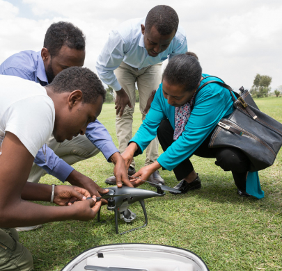
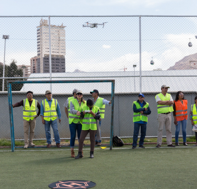
Updates

Emergency response
The World Food Programme (WFP) drone team is helping national authorities assess the areas most affected by Cyclone Kenneth, including Mucojo in northern Mozambique. Read the blog story written by WFP's Katarzyna Chojnacka, who recounts her recent mission to the village and how drones are helping relief efforts get a clearer picture of the situation.   ...
Community Participation
Damage Assessment
Flood Modelling
Communication
Capacity building
Drones take flight to aid humanitarian work in Ethiopia: Training equips government partners with skills to deploy latest technology. ...
Site Surveys and Line of Sight
Community Participation
Damage Assessment
Search and Rescue
Crop Monitoring
Flood Modelling
Emergency response
“It’s interesting to pair an emerging solution in the logistics world like the SHERP with an emerging solution in the tech world like drones. The two complement each other.”   ...
Cargo Delivery
Emergency response
Antonio Jose Beleza of Mozambique’s Institute of Disaster Management (INGC) saw the potential of drones in emergencies and has been implementing the technology following Cyclone Idai. ...
Community Participation
Damage Assessment
Communication
Capacity building
Bolivian society champions independent and strong women. With technology opening up new opportunities, female drone operators now appear on the horizon. ...
Community Participation
Crop Monitoring
Communication
Capacity building
Emergency response
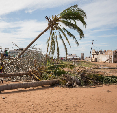
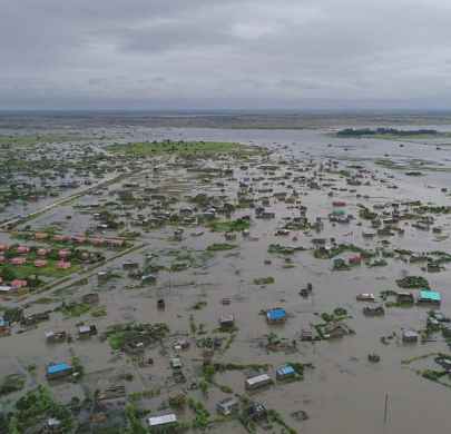
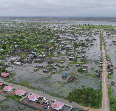
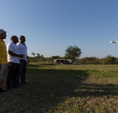
When tropical cyclone Desmond hit the north coast of Mozambique on 22 January 2019, roads in the fourth largest city Beira became rivers, the ground floors of homes and stores were submerged, and cars floated away. This time, emergency crews had cutting-edge technology on their side. Unmanned Aircraft Systems (UAS), commonly known as drones, were deployed to track rising flood waters and chart better evacuation plans for the people trying to escape them. ...
Site Surveys and Line of Sight
Damage Assessment
Search and Rescue
Flood Modelling
Preparedness

Above the clouds

From snow-capped peaks to lush rain forests, Bolivia’s diverse geography is breath-taking, but its vast and rugged terrain also poses challenges as authorities prepare for and respond to emergencies. There is eagerness in Bolivia to bring in drones to complement climate change adaption initiatives already happening on the ground. ...
Site Surveys and Line of Sight
Community Participation
Crop Monitoring
Preparedness
How innovation can support Afro-descendant and indigenous communities in Colombia.
Site Surveys and Line of Sight
Community Participation
Crop Monitoring
Capacity building
WFP facilitated the final component of a drone training series for Madagascar and Mozambique – Let’s MAP – during which 29 participants from 9 organisations learned how to process data captured by drones. To further the spirit of South-South collaboration, Mozambique’s INGC, which hosted and coordinated the learning experience, invited its counterpart from Eswatini to join the training. ...
Site Surveys and Line of Sight
Community Participation
Flood Modelling
Capacity building

A spark of inspiration

On a sunny October afternoon last year, the Bomberos de Bogotá (Firefighters of Bogota) received a call reporting the poor condition of a residential building with fears it might collapse. The Bomberos immediately sealed off the area and evacuated people at risk. Perhaps more importantly, they were able to assess the entire building quickly and safely using a multi-rotor drone. A few months earlier, that wouldn’t have been possible. Bomberos de Bogotá didn’t have the capacity, let a...
Community Participation
Damage Assessment
Search and Rescue