Updates

Emergency response
Preparedness
By WFP Mozambique's Research, Analysis and Vulnerability team   The district of Buzi is located downstream of the river with the same name. The riverbed runs along the district's village, where you can find many public and private infrastructures as well as a large part of the district's population and their respective areas of agricultural and cattle production, which are the main economic activities carried out in the district. According to the district health service, at the ti...
Over the past couple of years it has become clear that UAS regulation in most countries will be created and overseen by the National Aviation Authority (CAA). As a result there is or will be an expectation that UAS operators should adopt the principles of the ICAO Safety Management System (SMS), as set out in Annex 19 to the Convention and in more detail in ICAO Doc 9859 Safety Management Manual. What is equally clear is that many emerging UAS operators do not have a strong aviation...
Capacity building

Training of Trainers

As part of an initiative to build the training capacity in Mozambique, WFP in collaboration with the UN General Service Centre organised a two-week Micro UAS Training-Of-Trainers course from November 22 till December 03 2021 with the aim to train the first group of UAS certified trainers in the country. This will be a first step to create an Unmanned Training Organisation (UTO) in Mozambique.   ...
For humanitarians responding to an emergency, connectivity helps underpin coordination efforts. For someone who’s lost it all, staying in touch with family harbours hope, and knowing what local support is available is often a first step towards recovery.   ...
Connectivity
Emergency response
Preparedness
A World Food Programme (WFP) pilot project is set to push internet access during emergencies to new heights thanks in part to drone technology. By Tom Mallah   For humanitarians in an emergency, connectivity helps underpin coordination efforts. For someone who’s lost it all, staying in touch with family harbors hope, and knowing what local support is available is often a first step towards recovery. ...
Connectivity
Capacity building
Emergency response
Preparedness
Why automating analysis of aerial images is taking off for humanitarian response By Jean-Martin Bauer, Senior Advisor, Data, Digital and Innovation, WFP   ...
Emergency response
Preparedness
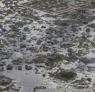
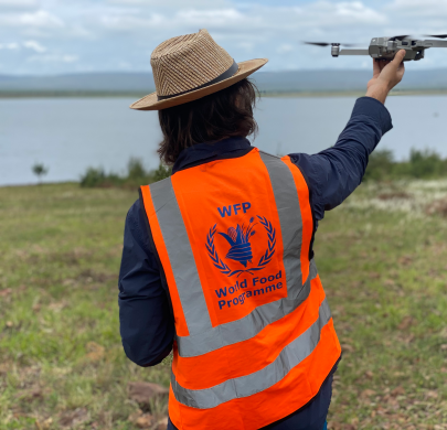
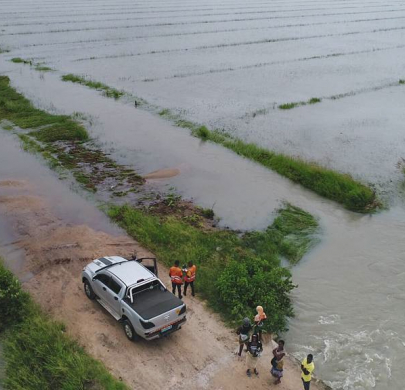
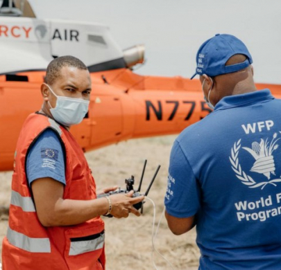
From Olympic opening ceremonies to public safety, drone applications have come a long way. This article, written by Iman Ghosh, Researcher and Writer at Visual Capitalist, explores the murky guidelines surrounding drone privacy laws around the world, and some case studies of how they’re used in every region. 
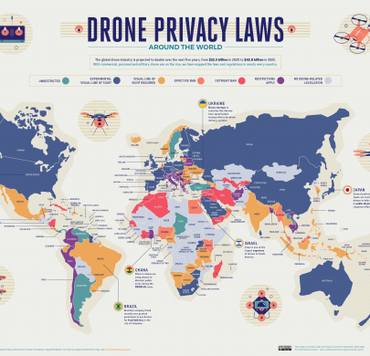
The map used in this article is taken from Surfshark. ...
Site Surveys and Line of Sight
Community Participation
Damage Assessment
Search and Rescue
Crop Monitoring
Flood Modelling
Connectivity
Communication
Cargo Delivery
Emergency response
By Enrica Porcari, WFP Chief Information Officer and Director of Technology The man with his eyes on the camera is Antonio Beleza, Deputy Director of Mozambique’s National Institute for Disaster Management and Risk Reduction (INGD). His intense gaze matches the situation 72 hours after tropical storm Eloise barrelled through Mozambique’s Sofala province, bringing floods and winds of up to 130km/h to a region still recovering from cyclone Idai, one of the worst disasters ever to hi...
Site Surveys and Line of Sight
Community Participation
Damage Assessment
Search and Rescue
Connectivity
Communication
Technical Working Group
Drones are a powerful technology for humanitarians because they save time when it is needed most. Work that once took days, like search and rescue and damage assessment after disasters, are reduced to hours with drones.   By Masa Sabbah, Information Management Officer, WFP Drones ...
Site Surveys and Line of Sight
Community Participation
Damage Assessment
Search and Rescue
Crop Monitoring
Flood Modelling
Connectivity
Communication
Cargo Delivery