By WFP Mozambique's Research, Analysis and Vulnerability team
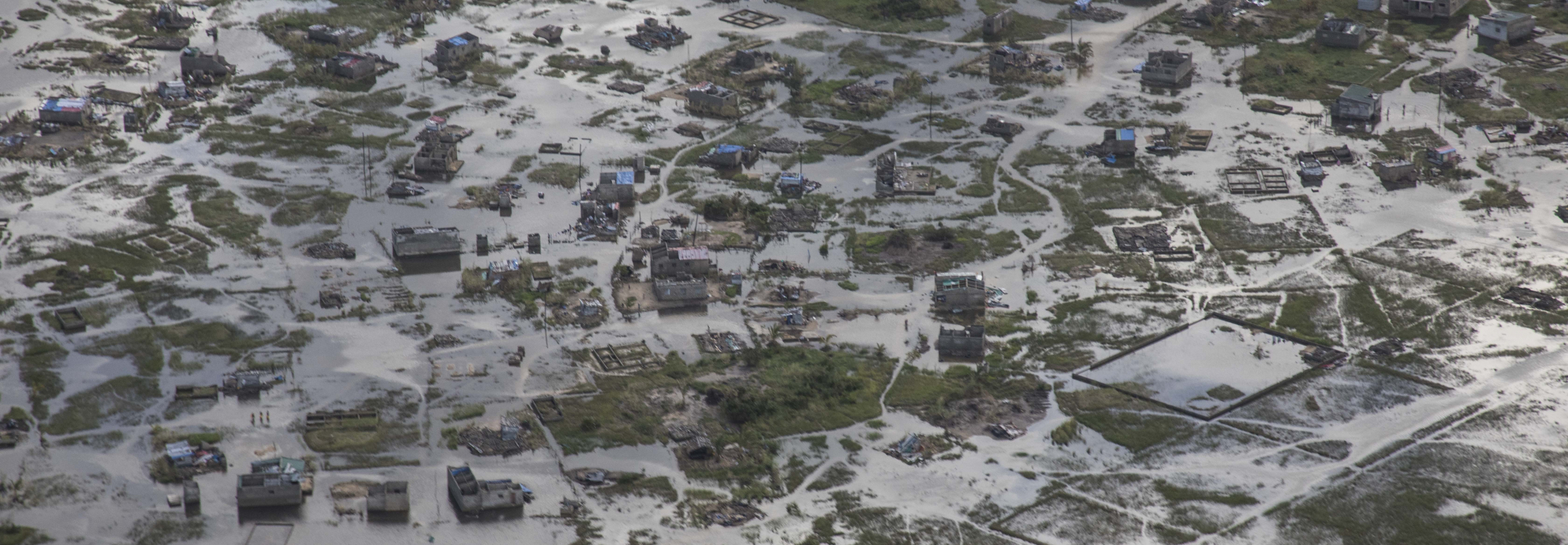
The district of Buzi is located downstream of the river with the same name. The riverbed runs along the district's village, where you can find many public and private infrastructures as well as a large part of the district's population and their respective areas of agricultural and cattle production, which are the main economic activities carried out in the district. According to the district health service, at the time of the occurrence of Idai (2019), the population was of 188.914 inhabitants.
During the cyclone, water coming from upstream carried by the Buzi River was one of the main risk factors that caused extensive floods and heavily impacted the population.
Given the increasing frequency of cyclones and storms that are hitting the area, the National Disaster Management Agency (INGD) in partnership with the World Food Programme (WFP) and funded by the European Civil Protection and Humanitarian Operations (ECHO), conducted an extensive mapping exercise of the Buzi river basin using Unmanned Aircraft Systems (also known as drones).